Smart GIS Map Editor and GPS Tracking

软件截图:
Smart GIS Map Editor and GPS Tracking
软件详细信息:
版本: 18.001
上传日期: 18 Jan 18
许可: 免费
人气: 154
尺寸: 12439 Kb

Rating: 1.5/5 (Total Votes: 2)

地理信息系统(GIS)是用于存储,检索,分析和显示地图数据的计算机程序。地理信息系统受地理,图形,数据库,操作研究,软件工程,软件编程和代码增强等地理信息系统编程不可或缺的各种科学的影响。

当前功能:
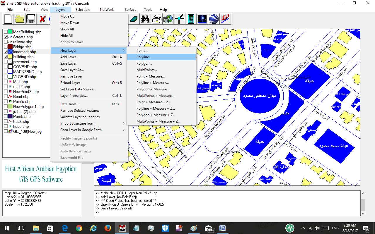
1)建立和编辑和数字化和查看形状文件及其相关的DBF文件。
2)空间分析,属性分析,表面分析,网络分析。
3)下载谷歌地球纠正地图图像和纠正光栅图像。
4)将桌面GIS形状文件转换为Autocad DXF文件格式,反之亦然。
5)将桌面GIS形状文件转换为Google KML文件格式。
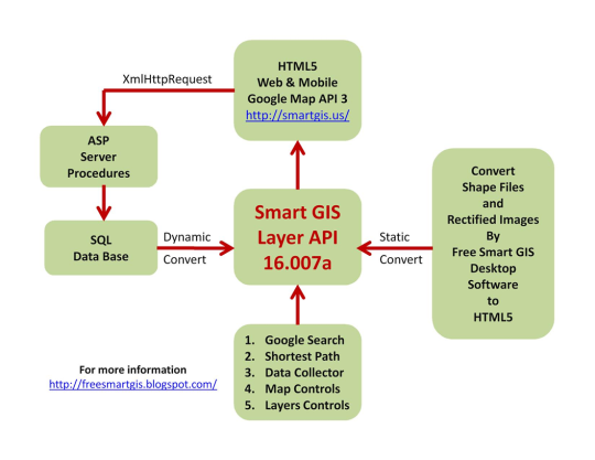
6)将桌面GIS形状文件转换成HTML5 Web GIS和Mobile App。
7)在线GPS追踪系统
8)将全站仪文件转换为GIS形状文件。
9)将横轴墨卡托转换为地理坐标系,反之亦然。

经历:
智能GIS软件已在世界银行也门和埃及的几个项目中使用,并由联合国空间数据基础设施(荷兰协调办公室)网站推荐。

截图

smart-gis-map-editor-and-gps-tracking_1_329820.png
smart-gis-map-editor-and-gps-tracking_2_329820.png
smart-gis-map-editor-and-gps-tracking_3_329820.png
smart-gis-map-editor-and-gps-tracking_4_329820.png
smart-gis-map-editor-and-gps-tracking_5_329820.png
smart-gis-map-editor-and-gps-tracking_6_329820.png
smart-gis-map-editor-and-gps-tracking_7_329820.png
smart-gis-map-editor-and-gps-tracking_8_329820.png
smart-gis-map-editor-and-gps-tracking_9_329820.png

支持的操作系统

类似的软件

Canvas 15
Canvas 15

30 Dec 14

pCon.planner
pCon.planner

3 May 20

Automapki x64
Automapki x64

25 Jan 15

显影剂的其他软件 Smart GIS Software

Smart GIS 2018
Smart GIS 2018

14 Aug 18

意见 Smart GIS Map Editor and GPS Tracking

评论没有发现
添加评论
打开图片!